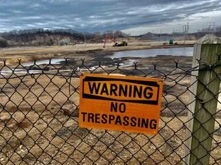
The Michigan EGLE recently added Harbor Island in Grand Haven to their list of PFAS sites. The Grand Haven site is a natural marshland at the mouth of the Grand River as it flows into Lake Michigan. The site was first used as a landing point for logging operations. During the 1950s and 1960s the site was used as a dump. The coal-fired J.B. Sims Generating Station began operating in the early 1960s by the Grand Haven Board of Light and Power (GHBLP). Coal ash wastes were disposed of in unlined lagoons and the adjacent wetlands. In the early 1980s, clay lined lagoons were constructed for coal ash management.
Michigan EGLE Updates PFAS Standards
Updated cleanup standards were announced by the Michigan Department of Environment, Great Lakes, and Energy (EGLE). For groundwater used as drinking water, EGLE has included five additional PFAS compounds to Part 201, making the total number of PFAS regulated in groundwater to seven compounds. Effective December 21, 2020, the compounds PFNA, PFHxS, PFHxA, PFBS, and HFPO-DA
Michigan’s PFAS Drinking Water MCLs Adopted
The State of Michigan formally adopted a strict set of requirements regulating PFAS in drinking water. The Michigan EGLE announced the adoption of the new maximum contaminant levels (MCLs), which will go into effect on August 3, 2020. The establishment of enforceable MCLs for PFAS compounds will require compliance with the Safe Drinking Water Act (SDWA). Now they are adopted, the PFAS drinking water MCLs replace the current groundwater cleanup standard of 70 ppt for PFOA and PFOS.
Michigan Adds 19 PFAS Contaminated Sites to List
In a continuing trend, another 19 sites with PFAS contamination have been added to the latest list of Michigan sites. The newest Michigan EGLE PFAS Map Tracker shows that the number of confirmed PFAS contaminated sites has grown to 93, up from 74 in December 2019 and 52 a year ago. The latest list of PFAS contamination includes sites spread across Michigan, throughout both the lower and upper peninsulas, in rural, suburban, and urban areas The EGLE also provides a PFAS map viewer, which provides information on the site name, location and address, description of the site, and a link to site-specific background, data, PFAS contaminants, site history, and recent activities.
Number of PFAS Contaminated Sites Continues to Grow
Michigan EGLE PFAS Map Tracker Confirms Growing Number of PFAS Contaminated Sites
Residents can now track the locations of PFAS sites in Michigan, which continues to grow. According to the most recent update to the PFAS Map Tracker from the Michigan EGLE (formerly MDEQ), the number of confirmed PFAS contaminated sites has grown to 52. The PFAS site map shows sites spread across Michigan.


